Public Version

2026-10-28
2026-11-05 Release Preview
What's New
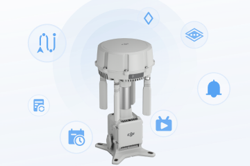
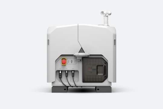
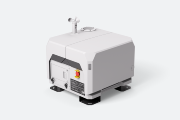
    New Features for DJI Dock 4
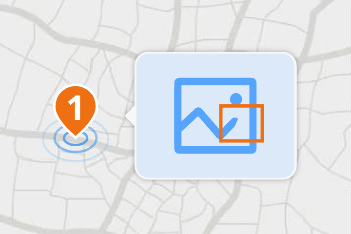
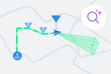
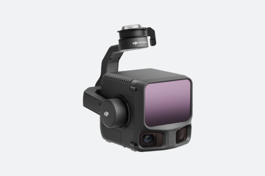
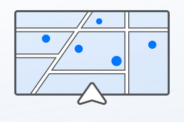
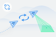
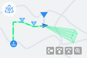
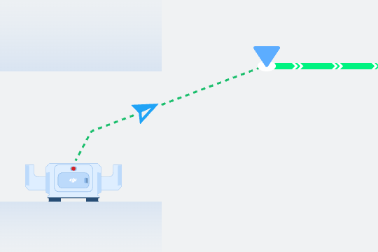
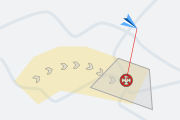
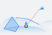
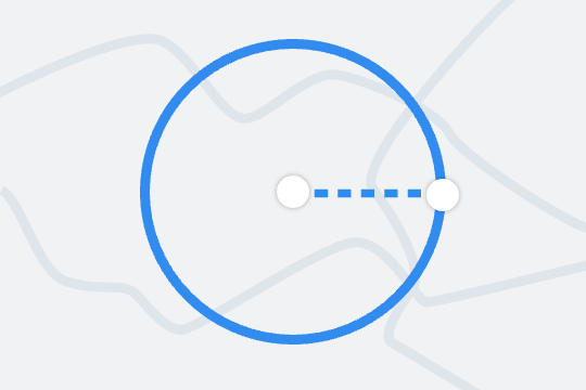
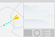
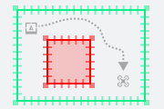
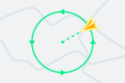
  • Support for Point of Interest (POI): Select a point of interest on the map to have the aircraft circle it, viewing and capturing the target from different angles.
  • Super-resolution photography is now supported, providing more detailed images for closer inspection of targets when zooming in.
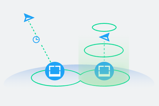
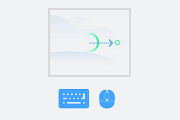
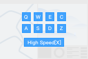
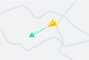
  • Select 21 m/s for FlyTo tasks on the map page of the Device Status Window to meet high-speed flight needs. Note the differences in obstacle avoidance capabilities in this mode.
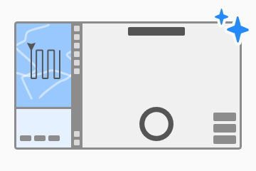
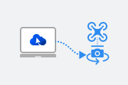
  • Enhanced Aircraft Control with FlightHub 2 Copilot
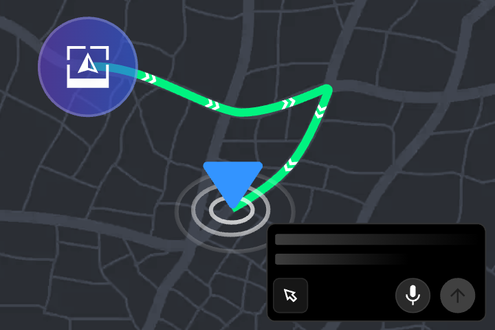
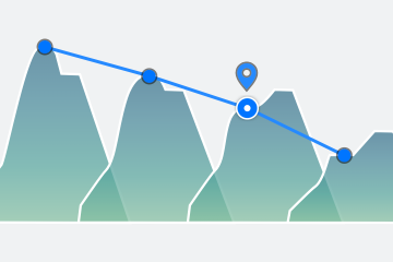
  • Copilot now supports real-time searches and flight along a route or across multiple points. You can issue long-horizon tasks such as: "Fly along the 10 selected Pin points and continuously search for fires. If a fire is detected, hover and switch to the infrared camera to take photos."
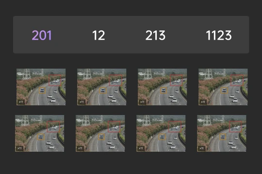
  • Copilot now supports OCR to recognize text in the camera view and generate a report.
  • EventAPI Adds Stage Event Notifications for Automatic Dispatch Workflows
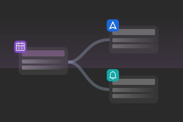
  • FlightHub Sync – EventAPI event notifications now include "Automatic Dispatch Workflow Stage Event Notifications". Once configured, events from each stage and their detailed parameters are pushed when an automatic dispatch workflow runs.
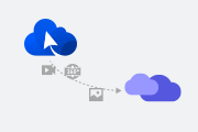
  • A new "One-Tap Snapshot" feature is available while an automatic dispatch workflow runs. Click the button to capture a snapshot of the current page and push it to the subscribed EventAPI rules.
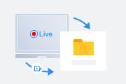
  • Sync Livestream Forwarding Can Now Follow Aircraft Propeller Start/Stop
  • For DJI Dock 3 and DJI Dock 4 aircraft, livestream forwarding can be configured to follow either propeller start/stop or aircraft power on/off.
  • Other aircraft models retain the existing behavior, with livestream forwarding following aircraft power on/off.
  • Volcengine Cloud Proxy Configuration for Public Cloud
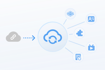
  • For restricted network environments such as corporate firewalls, FlightHub 2 supports configuring a Volcengine cloud proxy and displays fixed domain names, IP addresses, and ports for network allowlist configuration.
  • Once enabled, livestreaming, control, and voice features in FlightHub can use the cloud proxy connection, reducing connection failures caused by network restrictions.
  • Expanded Configuration for Third-Party Airspace Data Providers
  • FlightHub 2 supports configuring SafeSky and connecting other third-party airspace data providers that comply with the protocol via "Other Providers".
  • Organization administrators enter the provider information and API Key, validate and save the settings, and then select one provider to enable.
  • After the corresponding airspace alerts are enabled for a project, nearby aircraft information from the provider can be viewed on the map.
DJI Enterprise App
    View Target Alert Snapshots in Task Details
  • You can view media playback and target recognition alert snapshots in task records in the DJI Enterprise App.
  • Livestream Playback in a Floating Window
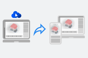
  • Switch to a floating window when watching livestreams in the DJI Enterprise App to view livestreams and manage tasks simultaneously more efficiently.
  • All livestream viewing in the app is free during the public beta. Download the app and try it out!
More Features
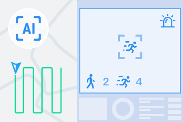
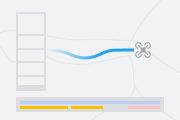
  • Intelligent recognition routes support new recognition types for DJI Dock 4, including intelligent recognition actions in waypoint routes and recognition of more targets, such as smoke/fire and animals, in patrol routes.
  • FlightHub 2 Copilot can now generate all nodes and parameters for periodic workflows, improving automation efficiency.
  • Patrol routes can now be dispatched from the cockpit while the aircraft is airborne, making routes easier to use.
  • The FlightHub 2 homepage now includes a plan purchase entry and supports batch activation of plans.
  • Photos, models, and design files displayed on the map can be shown or hidden with one click in the list for easier resource management.
  • This release preview is for reference only. Final released features may vary.
2026-10-14
New Supported Models
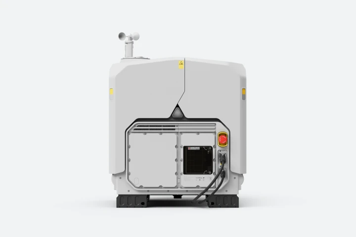
DJI FlightHub 2 Now Supports DJI Dock 4
DJI Enterprise App
  • The DJI Enterprise App supports creating, editing, copying, and suspending scheduled tasks, synchronized with the DJI FlightHub 2 Mission Library.
  • View, download, and share media files in task details within the app, synchronized with the DJI FlightHub 2 Media Library.
What's New
  • Copilot can now quickly generate automated workflows from natural language descriptions.
  • This release supports generating complete triggered workflows, including parameters, and partial periodic workflows, with node orchestration only and no parameters filled in.
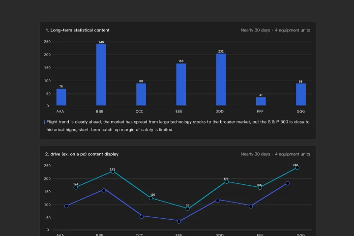
  • Copilot can now generate reports with charts and AI insights from natural language descriptions of flights, devices, or alerts.
  • Refine report content through multiple rounds of conversation until the final report meets your requirements.
  • No manual exports or chart creation are needed. The Agent automatically queries data, creates visualizations, and provides analytical insights.
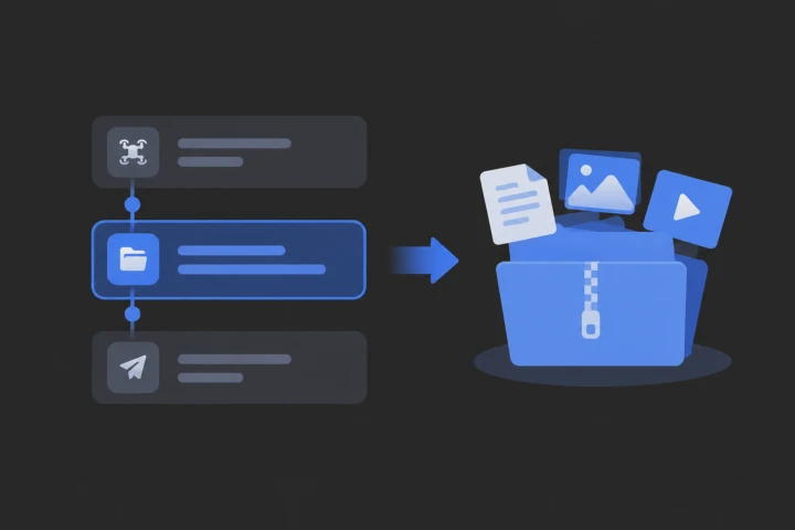
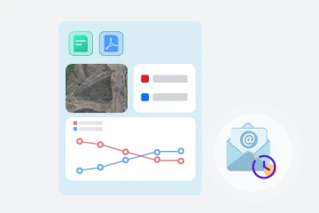
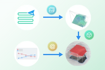
  • Task material packaging includes basic workflow information, media files, and flight records.
  • Task material packages can be shared via email and downloaded.
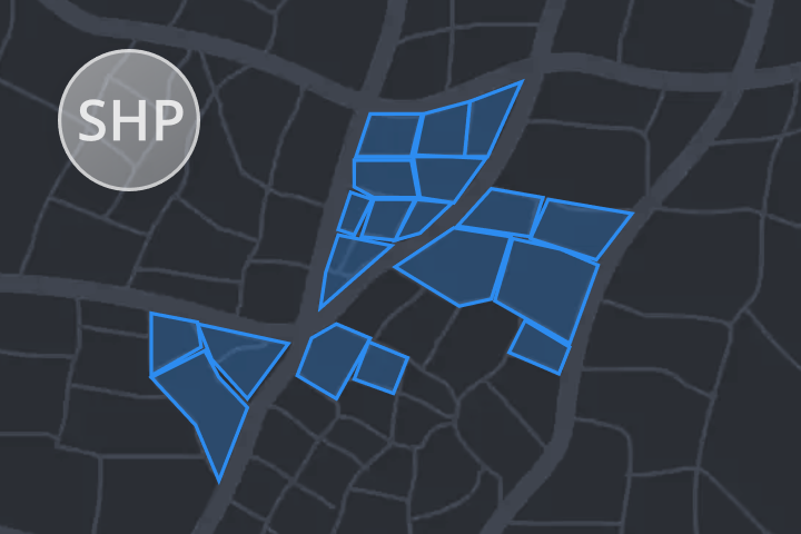
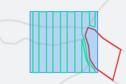
  • Import SHP file packages for clear visualization on the map, with support for custom rendering styles.
  • Convert existing annotations into layers to significantly improve map loading speed and interaction smoothness.
  • "Manned Aircraft Alerts", "Signal Map", and "GEO Zones" are consolidated into the layer list in the lower-right corner for centralized management.
  • A new toggle in layer settings makes it easy to hide element names on the map.
  • The annotation list now supports paginated loading and precise search, significantly improving loading speed and responsiveness.
Feature Optimization
Message Optimization
  • Updated message styling: regular messages automatically collapse after 8 seconds, while important alerts, such as device faults, remain visible to ensure they are not missed.
  • Alert messages from other projects are clearly identified and display the name of the project they belong to.
  • The new "Do Not Disturb for 7 Days" feature allows you to manually resume receiving messages at any time during the do-not-disturb period.
Livestream Billing Details Optimization
  • "Organization Settings > Organization Package Information" now provides online access to livestream billing details, along with detailed explanations of billing rules.
  • Livestream billing details now cover more billing types and display key information such as user accounts, device names, and lenses.
More Features
  • Search for a target point on the map by entering latitude and longitude.
  • Use the "Shift+F" shortcut in Map Photos and Map Annotations to quickly collapse or expand folders.
  • DJI FlightHub 2 now supports Italian and Polish.

2026-09-23
What's New
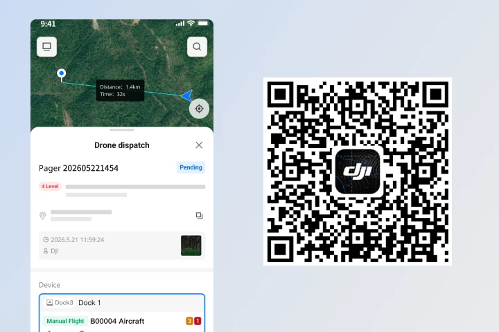
The DJI Enterprise App has been fully upgraded. During the beta period, livestream viewing in the app is available for free for a limited time.
Download now to quickly experience lightweight drone operation management capabilities, including:
  • Support for remote mobile viewing and control of drones and dock devices.
  • Real-time synchronized sharing of personnel, devices, and annotation locations.
  • One-tap on-site dispatch to quickly send drones to target locations (One-Tap Dispatch is not supported in the Public Cloud Standard version).
  • Support for deployment and debugging of DJI Dock series devices, ground stations, and relay stations (not currently supported on iOS).
  • Please refer to the DJI Enterprise App section for the manual.

Free Livestream Viewing Note: During the open beta period, free viewing is only available when the current organization's plan has remaining livestream hours.
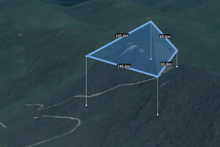

DJI Dock 3 Virtual Cockpit Supports 3D Line and Area Drawing
  • DJI Dock 3 supports laser pointing to draw 3D lines and areas within the Virtual Cockpit. Once completed, they can be viewed in map annotations.
Feature Optimization
  • Optimized the manual content to clarify DJI FlightHub 2 package introductions, purchase, activation and gifting rules, as well as relevant billing explanations.

2026-09-01
Feature Optimization
Smart Search Supports Count Statistics and Conditional Alerts
  • "Cockpit-Multimodal Smart Search", "Mission Library-Multimodal Configuration", "Analyzer-Smart Search": search results now display target count, support setting count alert thresholds in prompts, alerts are triggered only when conditions are met, and multi-target combined search is supported.
  • "Flight Records" and "Analyzer": smart search alert results support manual editing of AI search targets, as well as manually adding or removing targets.
More Features
  • The waypoint route editor supports setting ground alert altitude thresholds.
  • Analyzer model timeline supports filtering by model type.
  • For third-party developers and users who need to integrate FlightHub into an existing system, you can now refer to FlightHub Integration Skill to accelerate integration or explore potential solutions.

2026-07-30
What's New
  • Copilot can now generate waypoint routes by selecting annotation points, framing an area, specifying point locations, or via natural language descriptions. The generated routes can be saved to the flight route library or dispatched immediately for execution.
  • Periodic workflows now include VLM Smart Search and Change Detection Pro sub-modules, allowing AI analysis tasks to be configured directly within the workflow.
  • Trigger-based workflows now support the "Search In-Place" action, which can be paired with the smart recognition action to search for specific targets after the aircraft arrives at a designated location.
  • The workflow list now includes Notification / AI tags, and execution logs support viewing the trigger method and notification results.
Feature Optimization
  • Change Detection Pro task management has been fully migrated into the Analyzer, and a "Change Detection Pro" entry has been added to the Analyzer.
  • Change Detection Pro now supports manual modification of detection results.
  • Supports generating AI reports for Change Detection Pro, and refreshing reports after manual modifications.
  • Supports saving change annotations as defects and generating defect reports.
More Features
  • Multimodal recognition in the Cockpit and Smart Search in the Analyzer now support reverse geolocation calculation for up to 10 targets. The calculated coordinates are for reference only.
  • The map now supports creating spatial lines and spatial surfaces, which can be viewed on the map interface and in the Cockpit AR projection after being drawn.
  • Live share links now remember the page layout.
  • OpenAPI V2.0 Sample Source Code Release: After deploying and successfully running the sample source code, you can experience the functional interface developed based on OpenAPI V2.0. This helps you quickly understand how to integrate and use OpenAPI, and accelerates secondary development and integration. Access the documentation here:

2026-07-02
Feature Optimization
Analyzer Now Supports Smart Search
  • Supports automatic target information recognition by large language models. Recognized items can be manually converted into annotations mapped onto the model, and finally a job report can be generated.

2026-06-30
What's New
Automation - Trigger-Based Workflow Enhancements
  • Trigger-based workflows now support DJI Dock 2 as the operating device.
  • Added a multimodal recognition action that can be activated during flight or upon arrival at a specified location.
  • Customizable dispatch delay time is now supported, allowing immediate dispatch (0 seconds) after an alert is triggered.
  • You can now export alert points from the dispatch log to the project annotation folder with one click, making it easier to analyze alert hotspot areas.
  • The Event API now supports information synchronization for dispatch workflows, pushing alert process and result information to third-party systems.
  • Added a "False Alarm" indicator. You can mark a current alert task as a false alarm in the Cockpit, which can also be reviewed in the dispatch log.
Feature Optimization
Flight Records Now Support Viewing Video Files
  • Video file timeline track added: video files captured by the payload can be reviewed on the flight record timeline.
  • Flight record toolbar optimized: all media files generated during the flight mission can now be viewed in the media record.
More Updates
  • In-app message notifications now support filtering records by message title.

2026-06-17
New Hardware Support
O4 Ground Station Support Added
  • DJI FlightHub 2 now supports the "O4 Ground Station", enabling device management of cloud-connected O4 Ground Stations on DJI FlightHub 2.
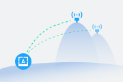
  • The Cockpit and Flight Plan Library now support "O4 Ground Station" as a signal enhancement device. Regular missions can select nearby available stations to connect, extending the operating range of a single sortie.
  • For network cameras connected through the "O4 Ground Station" via the ONVIF and GB/T 28181 standard protocols, you can view the video stream and remotely control them from DJI FlightHub 2.
  • For RID and ADS-B airspace broadcast receivers connected through the "O4 Ground Station", detected aircraft can be viewed on DJI FlightHub 2. You can also handle abnormal situations with one-click dispatch.
What's New
  • The Analyzer now supports defect annotation. Annotations on media files are precisely mapped to spatial positions on the 3D model in the Analyzer.
  • Click any location on the 3D model in the Analyzer to automatically receive recommendations of related photos that may have captured that point.
  • The spatial mapping between 2D media and 3D models has been comprehensively enhanced!
AGL Altitude Recording and Alerts
  • Enable AGL (Above Ground Level) altitude alerts in the Cockpit. An alert is triggered when the configured AGL value is exceeded.
  • Flight records now support calculating and displaying changes in altitude above ground during the flight. Note: This altitude is calculated based on the DJI FlightHub 2 global elevation model and may contain errors.

2026-05-27
What's New
OpenAPI V2.0 Public Cloud Edition Released
  • Building on the capabilities opened in V1.0, this version adds query interfaces for various business modules, covering organizations and projects, member permissions, live stream forwarding and sharing, flight tasks and records, map annotations, and more — further meeting the integration needs of third-party platforms for information queries.
  • This version also optimizes the API system by separating the public cloud and private cloud API documentation, making API categorization clearer for developers to quickly understand and integrate, and allowing OpenAPI to enter a more agile iteration cadence.
Live Share 2.0 Supports Sharing Multiple Devices at Once
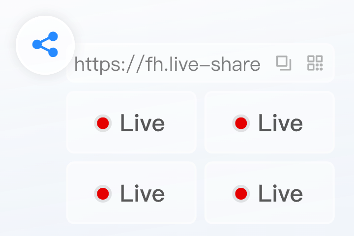
  • Live sharing has been fully upgraded to support adding multiple device live streams to a single share link.
FlightHub 2 Copilot Now Supports DJI Dock 2
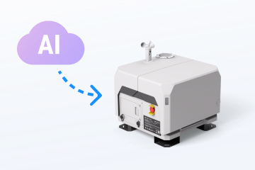
  • FlightHub 2 Copilot, the intelligent drone control assistant, now supports DJI Dock 2.
Feature Optimization
Automated Workflow Adds Trigger Configuration and Notification Module
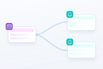
  • Automated workflow now supports trigger and notification configuration, allowing more flexible workflow triggering and outbound notifications of workflow status.
More Updates
  • The FlightHub project page menu can now be expanded to display menu names.
  • Notifications such as virtual cockpit AI alerts and automated assignment workflows now support sound alerts.

2026-05-08
What's New
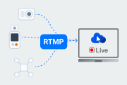
  • Supports connecting DJI consumer drones and handheld devices to FlightHub 2, enabling live streaming and viewing via RTMP.
  • Supports viewing live streams from streaming devices in the device window on the Project > Team page and on the multi-stream live view screen.
  • For devices connected via streaming, auto-recording can be enabled in project settings to record live footage in a timely manner.
More Updates
Feature Optimization
  • FlightHub Sync - Live Stream Forwarding now supports live stream quality settings.
  • FlightHub Mapping API now supports Zenmuse L3.

2026-04-15
What's New
Multimodal Recognition for Flight Routes
  • The task plan library now supports enabling multimodal recognition, allowing specified objects to be identified during flight route execution. Users are notified through designated methods when recognition is triggered.
Resource Library Recycle Bin
  • A recycle bin has been added to the resource library. Deleted files are moved to the recycle bin first. Periodic auto-emptying can be configured to free up storage space.

2026-03-31
What's New
  • Copilot, an intelligent aircraft control assistant, is now available in the FlightHub virtual cockpit. Use natural language or voice input to control the drone in real time and execute complex tasks.
  • Added support for 500MP high-definition panoramas for DJI Dock 3 and DJI Matrice 4 Enterprise. Environment information can be collected efficiently.
  • 3x zoom can be set in virtual cockpit and waypoint route settings to capture sphere panoramas, automatic stitching is available after capture, and high-definition results can be viewed in the media file library. Related features such as analyzer import and timelines are supported.
  • Powered by the VLM, Change Detection Pro removes angle limitations. It can now detect changes even from non-orthophoto photos taken at the same waypoint.
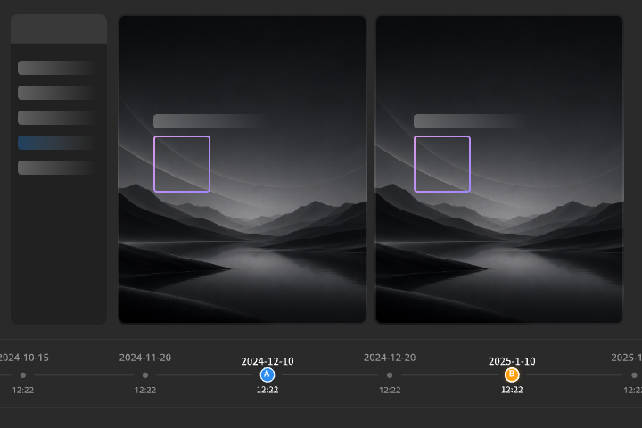
  • The analyzer timeline now includes a SBS view, allowing users to compare any two inspection datasets from the same waypoint route. Change Detection Pro highlights changed areas, making inspection reviews more efficient and intuitive.
Resource Library Upgrade
  • The original Media Library, Model Library, and Design Files have been merged into the “Resource Library” for unified, more convenient management.
  • FlightHub 2 FlightHub Sync Beta has completed testing and validation. It will be gradually phased out and replaced by the new FlightHub Sync.
  • File Sync – Now supports cross-configuration of file type, project, and bucket. Multiple buckets can be configured.
  • Telemetry Data Sync – A new telemetry data sync feature that enables real-time sync of the attitude data to third-party platforms.
  • RTSP Protocol – Livestream forwarding now supports the RTSP protocol.
  • Third-Party Airspace Data Management – Supports configuring airspace information from third-party providers and displaying it within FlightHub.
What's New
What's Updated
  • Added support for Portuguese and Russian.
  • Supports setting the earliest/latest execution start time in New Task of the task plan library.
  • Supports repair requests after Device Damage Assessment and Issue Reports, as well as direct one-click repair requests, simplifying the troubleshooting process and improving O&M efficiency.

2026-01-27

DJI FlightHub 2 officially launches a brand-new business version. The previous professional versions (1-month/12-month/3-year) will be discontinued. Users whose professional versions are within the validity period before the discontinuation will be automatically upgraded to the new business version free of charge. At the same time, the features available in the standard version will also be adjusted.

    【Launch of the New Business Version】
    • The new business version offers a wider range of advanced features. Beta features currently in trial will also be officially supported.
    【Discontinuation of Professional Versions (1-Month / 12-Month / 3-Year)】
    • The current professional version will be removed from both the online store and authorized agent/distributors. Versions that have already been purchased or activated will remain available and will be upgraded to the business version at no cost.
    【Adjustment to Mapping Image Packages】
    • The previous 20,000-image package will be removed from both the online store and authorized agent/distributors. The new mapping image recharge package will be introduced. Already purchased or activated image packages can still be used normally.
    【Changes to Standard Version Features】
    • Relaxed Restrictions
      • The standard version will no longer limit the number of projects or the number of models loaded to the map in each project.
    • New Restrictions on the Standard Version
      • The maximum number of user accounts per organization will be set to 5. The following features will not be supported: custom project roles and permissions, exporting flight records locally, viewing organization data dashboard, creating analyzers, sharing project data within the organization, linking analyzers in automated workflows, and automated assignment workflow. Virtual cockpit will support official algorithms for people, vehicle, vessel, and large-object detection, but third-party algorithm-based detection will not be supported. AI waypoint and patrol routes will support official people, vehicle, and vessel detection, but not third-party algorithms. Smart search will be limited to 4 uses per organization per month. Change detection will be limited to 4 uses per organization per month.
    • Retention of Existing Data
      • All accounts already added to organizations, custom project roles and permissions, and analyzers created before these changes take effect will remain and will not be deleted.

      For more details, please visit the DJI Store. If you have any questions or suggestions, please feel free to contact us.
What's New
  • Added FlightHub Mapping API in OpenAPI, supporting third-party fast integration of cloud mapping capabilities.
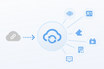
  • Added support for EventAPI, which allows you to configure different event rules to push specific event information from FlightHub to external systems.
  • Added support for deleting files within FlightHub after synchronization is completed.
What's More
What’s Updated
  • Added support for searching all device serial numbers and device names on the team page and in the Device List in Task Plan Library.
  • Added virtual cockpit entry to Device List on team page.
  • FlightHub public cloud now allows docks to import offline unlocking licenses to lift flight restrictions.

2026-01-05
What's New
Added Gaussian Splatting in Cloud Mapping
  • Scenes with fine structures or glass curtain walls are now rendered more realistically and clearly.
  • (It is recommended to use the host configuration suggested by FlightHub)
Added Direct Model Viewing in Model Sharing
  • Scan code with mobile device to view models instantly without login.
  • Project annotations can now be displayed simultaneously in the Analyzer map settings. You can also select annotations and convert them to measurements with a single click.
Added ICAO Filtering in AirSense
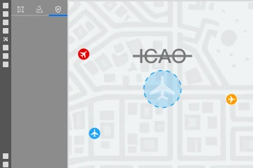
  • On the Team page, the Map Task Area has been upgraded to airspace information management. AirSense alert management is now available, and ICAO number filtering is supported.
What's More
What’s Updated
  • On the Task Logs page, you can now directly view the output of each stage in automated workflow.

2025-12-11
What's New
  • On the automated workflow page, you can create an automated assignment workflow, then trigger the workflow manually on the map or through an external system. After the aircraft arrives at the specified coordinates, preset actions will be performed automatically.
  • Added support for selecting 3x or 7x zoom lens.
  • Added support for DJI official and third-party infrared object detection algorithms.
  • Added support for speaker and spotlight alert actions.
Added Real-Time AI Alert Settings to Virtual Cockpit
  • During real-time flight, onboard official and third-party algorithms support setting alert thresholds. After an alert is triggered, relevant alerts will be collected in the alert list.
Optimized Rapid Mapping Feature
  • Added support for enabling rapid mapping when distributing mapping-related tasks. The aircraft will transfer real-time thumbnails during flight, and modeling will start automatically after the transfer is complete, quickly generating models for emergency scenarios.
  • Added support for creating point and historical elevation measurements in analyzer. You can draw points on the map to obtain the point's geographic location and surface heights of historical models.
  • On the analyzer sharing page, you can view the model media file timeline, measurement results, and analysis report directly by scanning the QR code via mobile device without login.
What's More
What's Updated
  • Added support for the object segmentation algorithm in onboard algorithms.
  • Added support for continuing to perform remaining steps after an automated workflow is disabled.
  • Added support for following the organization settings for imperial units in analyzer.
  • Added support for setting the expansion coefficient in analyzer volume calculation.
  • DJI Dock 3 Car Mount supports custom network RTK calibration.
  • DJI Dock 3 supports clearing all aircraft unlocking licenses with one click.

2025-11-4
New Model Support
Adds Support for Zenmuse L3 Payload
  • Supports planning flight routes for Matrice 400 enterprise aircraft with the Zenmuse L3.
  • Area Route now supports displaying a preliminary report of the L3's point cloud results to assess the expected data quality in advance.
  • Supports viewing L3 point cloud files uploaded from the Pilot 2 app.
What's New
  • Enable this feature in Organization Settings > Organization Data Management > Airspace Management Service Provider Flight Data Reporting. After entering the address and token provided by the third-party service provider, flight data will be pushed to them in real time.
  • The analyzer now supports setting an elevation calibration point. The model surface elevation at the selected location will be calibrated to a target value for all current and future models. This calibrated elevation will be applied to all measurements and calculations.
What's More
What's Updated
  • Adds support for Japanese, Korean, German, and French.
  • Supports filtering the annotation list to display annotations as needed.
  • The gradient calculation and triangulation tools are optimized to perform dynamic calculations that follow the model surface.

2025-9-23
  • Redesigned Interface: A complete visual and interactive optimization for a more intuitive experience.
  • Flexible Layouts: Customize the interface with new layout options to fit your needs.
  • Updated Icons: A brand-new icon set provides a cleaner, more refined look for improved clarity.
  • Streamlined Interactions: The user experience has been optimized to make operations faster, smoother, and more intuitive.
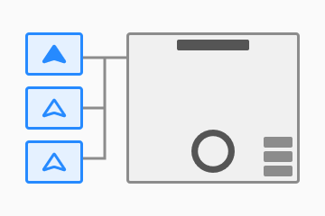
  • Manage a group of aircraft for collaborative tasks using the new multi-aircraft control panel.
  • Instantly switch control between different aircraft, enabling a single operator to manage multiple drones.
  • AR projection now supports virtual lines and areas for enhanced situational awareness.
  • View spatial lines and areas drawn in DJI Pilot 2 directly in the live view.
  • Adds support for dashboard, a new centralized hub for viewing key operational data at a glance.
  • Designed for administrators, it provides the high-level insights needed for effective management.
  • Track core metrics including assets, device status, task schedules, and data outputs to support informed decision-making.
  • Find what you're looking for faster. Smart Search automatically detects and tags objects in your photos and videos.
  • Export search results as a detailed report for sharing, documentation, and further analysis.
  • Administrators can now manage data across the entire organization. Easily view and copy annotations, flight routes, models, and GEO Zones between projects.
  • Save time by editing multiple waypoints at once. You can now batch-modify waypoint parameters and actions in the Flight Route Editor.
Centralized Message Center
  • All notifications are now aggregated into the new Message Center. View historical system messages and customize which alerts you receive in your personal settings.
  • Cloud reconstruction supports setting image control points, and standard targets support automatic piercing and reconstruction.
What's More
2025-9-16
New Model Support
  • Supports the Mavic 3T Advanced enterprise aircraft, its gimbal camera, and connected PSDK accessories.
  • Supports point, line, and area annotations for Mavic 3T Advanced enterprise aircraft.
2025-8-28
What's New
  • Adds support for remote management and use of Manifold 3 applications via the cloud.
  • Device Management: Adds support for device display and application management for Manifold 3.
  • Virtual Cockpit: Enables launching loaded applications and viewing their effects in real time.
  • Virtual cockpit adds support for third-party infrared AI recognition algorithms.
  • Users can now view real-time AI recognition results from infrared cameras.
  • For waypoint and patrol routes, you can now choose third-party intelligent algorithms on the aircraft to perform recognition tasks.
  • Flight records now support exporting reports for AI-generated warning events.
What's More
  • You can now set the threshold for crewed aircraft collision risk (Effective only for dock aircraft).
  • Adds support for setting a reserve battery level for return-to-home for dock aircraft. In strong winds, it’s recommended to increase this value for safety.
  • Virtual cockpit now supports infrared photo format settings.
  • Adds a comprehensive guide to package options and billing methods.
2025-7-31
What's New
Multimodal Object Detection
  • Virtual cockpit now supports multimodal object detection.
  • Users can define the objects that trigger warnings by entering text, uploading images, or selecting objects in real time.
  • Snapshots will be automatically archived to a dedicated folder in the media file library, with support for tag-based filtering.
  • You can configure warning notification types and set record intervals.
AI Warning Record List
  • The AI warning record list in the virtual cockpit and flight records has been upgraded.
  • Supports archiving and displaying records generated by multimodal object detection and cloud-based intelligent algorithms.
AR Street Projection
  • The virtual cockpit now features AR street projection.
  • Supports adjusting opacity and height offset, as well as displaying landmarks.
AI Assistant
  • An AI Assistant is now available in the help pop-up window.
  • The AI Assistant can intelligently answer product usage questions using content from FlightHub 2 public and on-premises product manuals, on-premises deployment manuals, and other documentation.
What's More
More Updates
  • Organizations can now enable Two-Factor Authentication for login to enhance FlightHub account security. Once enabled, members must bind an authenticator and enter a dynamic code to complete the login process.
2025-6-26
New Analyzer Feature: Supports Engineering Measurement and Progress Management
Measurement and Calculation
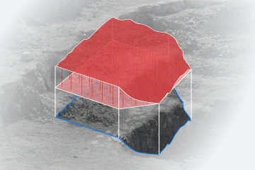
  • Measurement and calculation tools can be created in the analyzer, enabling line and volume measurements based on models and design files.
  • Line Measurement: Supports triangulation and gradient measurements and allows extraction of cross-sections.
  • Volume Measurement: Supports current model volume calculation, two-phase and multi-phase model volume change calculations.
Timeline
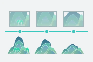
  • Supports viewing model timeline, allowing quick and dynamic switching to display the model evolution process and intuitively track project progress.
  • Supports viewing media timeline, enabling association and viewing media files by time and spatial dimensions for visual traceability and process management.
Analysis Report
  • Supports generating measurement analysis reports, with configurable report covers, measurement areas, and other structured content.
  • Supports report templates, scheduled automatic report generation, and email delivery, facilitating progress tracking, data archiving, and reporting.
What's New
Automated Workflow
  • Full Process Integration: Integrates flight, mapping, measurement, calculation, and analysis tasks for end-to-end automation from data collection to intelligent analysis.
  • Flexible Task Management: You can freely choose from existing tasks or create new ones, with support for editing and linking to meet different scenario requirements.
  • Efficient Preview and Performance: Preview task results with one click, quickly save and enable automation to improve operational efficiency.
Design File Support
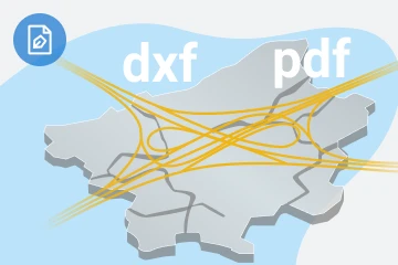
  • Supports PDF and DXF formats. Design files can be accurately positioned on the map via coordinate system conversion or matching point calibration.
  • Supports parsing 3DFACE (DXF) to obtain design heights for cross-section and volume calculations.
Engineering Coordinate System
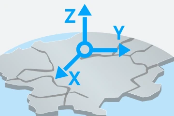
  • Project settings now support engineering coordinate system configuration.
  • Supports EPSG universal and custom projected coordinate systems.
  • Supports four or seven parameter calculation and application.
What's More
  • Adds Spanish language support for the interface.
2025-6-10
New Product Support
DJI FlightHub 2 now supports DJI Matrice 400.
  • FlyTo tasks are now available for Matrice 400.
  • Adds support to remotely control Matrice 400 gimbal camera and PSDK accessories.
  • Adds support for flight route planning for Matrice 400.
What's New
AI Capabilities Support
  • Patrol routes are now available. Users can specify areas for inspection, and the system can automatically identify people, vehicles, and boats within the patrol area using intelligent recognition algorithms and send alert notifications.
  • The virtual cockpit now supports real-time AI recognition of people, vehicles, and boats, and can automatically send alerts based on infrared video streams.
  • The media file library in FlightHub now supports displaying, viewing, and sharing AI-generated videos on the aircraft, showcasing AI recognition results.
  • Adds support for live flight controls of Matrice 4D series aircraft when connected via remote controller.
  • Users can now issue return-to-home commands to all aircraft within a project with a single click.
  • Users can now load third-party algorithms distributed from the DJI Developer website onto aircraft connected to docks via the Algorithms page.
  • FlightHub Sync Beta has been upgraded to FlightHub Sync. Users can synchronize specified project media files, flight routes, flight records, and other information to external storage buckets.
Compliance Requirements in Chinese Mainland
  • Aircraft operating in the Chinese mainland must report flight dynamic data to the Civil Aviation Administration. Go to My Organization > Organization Settings > Organization Basic Information to view details and enable the feature.
What's More
  • Flight records now support compatibility with DJI Dock 2.
  • When distributing tasks, the system checks the flight route's historical obstacle sensing records and prompts if any exist. If obstacle sensing is triggered during recurring or continuous tasks, subsequent tasks are automatically suspended and must be manually resumed to ensure safety.
  • Adds support for automatic association of abnormal feedback with dock or aircraft logs. After selecting the time, data is automatically matched and the error code field is filled in to improve problem analysis efficiency.
  • Supports remote switching between FlightHub public and on-premises environments for docks.
2025-4-15

Starting from April 15, 2025, the DJI FlightHub 2 package adjustments will be effective:

  • New Packages
    • Enterprise package, only limits the number of online devices. There are no restrictions on livestream and storage usage, offers extra-large mapping images package and advanced features like SSO login.
    • Introduction of larger capacity options for Livestream Minutes Recharge, and Storage Space Upgrades.
  • Original Package Adjustments
    • Activation Validity: The enterprise package has no activation period, whereas other packages ( Professional Version 1-Month Plan, Professional Version 12-Month Plan, Professional Version Large Capacity 3-Year Plan, Mapping Images Recharge, Livestream Minutes Recharge, Storage Space Upgrade) have a 6-month activation validity.
    • After activation, the livestream minutes recharges, mapping images recharges, and storage upgrades have a 1-year usage period.
    • The above adjustments apply only to packages purchased on or after April 15. Previously purchased packages will retain their original terms.

    For more details, please visit the DJI Store. If you have any questions or suggestions, please feel free to contact us.

What's New
  • The enterprise package supports SSO login, allowing login through third-party enterprise accounts.
  • On the team page, click the FlyTo destination, and the system will automatically sort and recommend suitable docks for the user to choose from.
  • When creating a new plan in the Task Plan library, after selecting a flight route task, the system will automatically sort and recommend suitable devices based on the distance between the first waypoint and the dock.
  • The virtual cockpit supports creating automatic swap tasks. After choosing an area of interest, it automatically schedules two aircraft to swap for uninterrupted observation.
  • This feature currently only supports DJI Dock 3.
Flight Route Distribution via Virtual Cockpit
  • The virtual cockpit supports viewing tasks in the flight route library. Users can select, distribute, and perform waypoint routes and area routes.
  • This feature currently supports DJI Dock 3, DJI Dock 2, and Matrice 4 enterprise aircraft.
  • The Task Plan library supports displaying manual flight tasks controlled via the virtual cockpit or the remote controller.
  • Adds support for displaying device change information during flight, aircraft key behaviors, user commands, and more.
  • Adds support to export summary or detailed information of flight records.
  • This feature currently only supports DJI Dock 3.
  • DJI Dock 3 can now search for relays nearby. Users can select a relay device and enter a password to connect.
What's Updated
Waypoint Route Supports POS Data Recording
  • The Waypoint route adds a Record Current Attitude action, allowing one-click capture of the current virtual aircraft's gimbal yaw and tilt angles, aircraft yaw angle, and camera zoom level. These data are then added to the action list.
  • The Waypoint Route Editor adds a Sync POS Info When Adding Waypoints setting in the upper right corner. When enabled, it will automatically add the aircraft's POS information when adding new waypoints, improving waypoint route editing efficiency.
More Updates
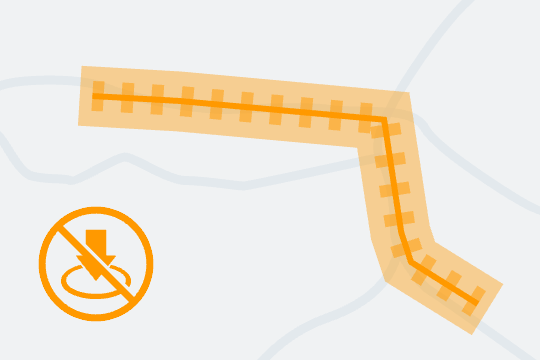
  • When DJI Dock 2 performs an area route, it supports automatic obstacle bypassing of custom GEO Zones when the aircraft is flying to the first waypoint. The setting needs to be enabled in the area route editor > Advanced Settings > Custom GEO Zone Obstacle Bypassing.
  • Gimbal tilt angle of Matrice 4T when performing waypoint routes is now extended to 70 degrees.
  • DJI Dock 3 aircraft supports more payload capacity.
  • The device list adds a visual display of aircraft payloads and accessories, making it easy to quickly select suitable docks and aircraft.
2025-3-19
What's New
  • Project role management enables detailed control over member permissions within a project by assigning various permissions to different roles.
  • Organization administrators and super administrators can manage project roles within the organization via Members > Member Role Management > Project Member Role Management.
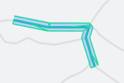
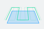
  • The flight route library now supports creating linear flight routes, which are suitable for mapping scenarios such as rivers and pipelines.
  • Area routes support Custom GEO Zone Obstacle Bypassing within Advanced Settings, allowing the aircraft to bypass custom GEO Zones during mapping.
  • This feature is currently supported by DJI Dock 3, Matrice 4 Enterprise Series, and DJI Dock 2.
Cloud Intelligent Algorithms
  • Users can deploy intelligent algorithms via Algorithms on the cloud.
  • Users can instantly call successfully configured cloud intelligent algorithms and instances in the virtual cockpit.
  • Users can view deployable intelligent algorithm models from vendors on the DJI Developer platform.
  • Supports configuring devices within the project for automatic livestream recording.
  • Recorded files will be archived in the media file library under the Auto Record Playback folder.
  • Supports flexible cleanup cycle settings to automatically free up storage space.

What's More
More Updates
  • Added more layout modes and improved user experience for simultaneous livestreams.
2025-2-27
New Product Support
DJI FlightHub 2 now supports DJI Dock 3.
Accessory Support
  • DJI Dock 3 supports the D-RTK 3 Relay Station and DJI Dock 3 Vehicle-Mounted Gimbal Mount.
  • Matrice 4D series aircraft support the DJI AS1 Speaker, DJI AL1 SpotLight and DJI FTS Module(For countries in Europe only).
What's New
AI Capabilities Support
  • The virtual cockpit supports real-time AI recognition and automatic alerts when people, vehicles, or boats are identified, and provides the ability to view detailed alert records generated during tasks in real time.
  • The virtual cockpit supports Smart Track, allowing continuous tracking of AI-recognized objects.
  • Waypoint routes support intelligent recognition actions, capable of recognizing people, vehicles, boats, or subjects with abnormal high and low-temperature during the flight, and performing actions such as taking photos, recording videos, and waiting for the operator to take over after alerts.
  • The plan library now supports AI route warning notification, allowing the configuration of alert receiving methods and frequency after subject recognition.
  • The above features are currently only supported by the Matrice 4D series aircraft.
AI Change Detection
  • Media File Change Detection: The media file library supports intelligent detection and marking of changes in photos from two media folders generated by the same waypoint route task.
  • Model Change Detection: The model library supports intelligent detection and marking of changes in two overlapping 2D models.
Vehicle-Mounted Deployment Mode
  • Adds support for quick calibration of device location and pre-flight safety checks in vehicle-mounted deployment mode.
  • The feature is currently only supported by DJI Dock 3.
  • Adds support for scheduling devices to take off or land in areas where docks are densely deployed.
  • The feature is currently only supported by DJI Dock 3.
  • DJI FlightHub 2 adds a new type of no-landing zone in custom flight areas, preventing aircraft from automatically landing within these zones.
  • Users can manually draw no-landing zones or convert map line annotations into no-landing zones automatically.
  • Adds support for sending no-landing zones to DJI Dock 3 and Matrice 4D series aircraft within the project to enhance flight safety.
Entry/Exit Route
  • Adds support for performing the entry/exit routes after takeoff to ensure safe departure before performing flight tasks.
  • The feature is currently only supported by DJI Dock 3.

What's More
More Updates
  • Matrice 4D series aircraft support the Night Scene mode.
  • The Mouselook feature in the virtual cockpit has been upgraded.
  • Resolution settings are now supported during model mappings.
2025-1-8
New Product Support
DJI FlightHub 2 now supports DJI Matrice 4 enterprise series
  • Adds support for Live Flight Controls for Matrice 4 enterprise series aircraft.
  • Adds support to remotely control gimbal cameras of Matrice 4 enterprise series aircraft.
What's New
AI Recognition
  • Adds support to remotely control Matrice 4 enterprise series to intelligently recognize people, vehicles, and boats, and alert users after recognition.
  • Third-party algorithm models developed on DJI AI Developer platform can now be imported into Pilot 2 to expand AI recognition scenarios.
  • Media file library supports display, counting, and editing of AI recognition results. Currently only wide-angle and zoom photos are supported.
  • The feature is currently only supported by Matrice 4 enterprise series aircraft.
Smart 3D Capture Route
  • Rough models can now be generated during model mapping and used for creating Smart 3D Capture routes.
  • Adds support for Smart 3D Capture in the flight route library, allowing generation of flight routes based on rough models and simplifying mapping tasks.
  • The feature is currently only supported by Matrice 4 enterprise series aircraft.
Enhanced Ortho Collection for Area Routes
  • Smart Oblique can now be enabled to improve efficiency during ortho collection when aircraft is performing area routes. It is recommended to use the feature for ortho mapping tasks only.
  • The feature is currently only supported by Matrice 4 enterprise series aircraft.
Observed View Synchronization
  • Adds support for syncing observed views from Pilot 2 to FlightHub 2.
  • The feature is currently only supported by Matrice 4 enterprise series aircraft.
Spatial Annotation Synchronization
  • Adds support for syncing spatial annotations from Pilot 2 to FlightHub 2.
  • The feature is currently only supported by Matrice 4 enterprise series aircraft.

2024-11-7

Starting from November 7, 2024, DJI FlightHub 2 officially adjusts its policy on free quotas for device binding.

  • Changes to the allocation logic:
    • Organizations can receive free quotas when binding a device (Dock or aircraft) for the first time.
    • An organization can only receive free quotas once. If an organization has already received free quotas, it cannot receive them again when binding additional devices.
    • A device can only receive free quotas once. If a device has already received free quotas, it cannot receive them again when re-bound to another organization.
  • Changes to the amount and validity of free quotas:
    • The amount of free quotas will no longer vary by device type. All devices will receive 100GB storage space, 5000 livestream minutes, and 3000 mapping images.
    • The validity period of the free quotas is 3 months.

From November 21, 2024, compressed files will count towards storage. If storage space is insufficient, files that occupy extra space will not be deleted, but new files cannot be added. It is recommended to download, archive, or delete compressed files to avoid exceeding the storage limits. If you have any questions or suggestions, please feel free to contact us.
What's New
Livestream Management
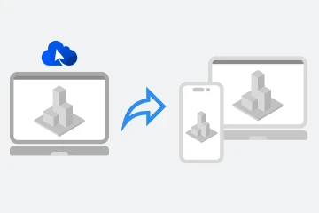
  • Adds support for simultaneous livestreams for multiple devices within a project. Supported devices include the security cameras of the docks and the gimbal cameras of the aircraft.
  • Adds support to choose different grid layouts for livestream display.
  • Users can also recenter the device on the map, press keyboard shortcuts to enable the livestream view in full screen, adjust the on-screen display information, and select between different livestream display modes.
Flight Route Management
  • Adds support for automatically swapping continuous actions such as starting and ending recordings when reversing flight routes.
  • Adds support to download flight routes in batch.
Dock Management
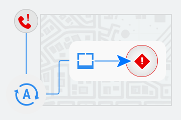
  • Adds support to subscribe to notifications when the dock cover is not closed for an extended period of time.
  • Adds support for submitting issue reports in the Task Plan library and warning message panel.
  • DJI Dock 2 now supports vision assist.
  • DJI Dock 2 now supports emergency landing.
  • DJI Dock 2 now supports timed shots, storage settings, resolution settings, Link Zoom, and more.
  • DJI Dock 2 now supports device damage assessment.
  • Base station PPK files can now be transferred back to FlightHub 2, and the files will be stored in the corresponding flight route folder in Media Files.
  • More battery data will be displayed for DJI Dock 2.
Online Support
  • Users can now feedback system problems, make optimization suggestions, and obtain quick assistance.
Third-Party Flight Task Distribution
  • FlightHub Sync now supports distributing flight tasks from third-party cloud platforms, and the tasks will be synchronized to DJI FlightHub 2.
What's Updated
  • Optimized organization package information. Users can now view the details of storage space, mapping images, and livestream minutes.
  • Optimized the map searching feature.
2024-9-24

DJI FlightHub 2 is expected to officially adjust its policy on free quotas for device binding in November 2024.

  1. Changes to the allocation logic:
    • Organizations can receive free quotas when binding a device (Dock or aircraft) for the first time.
    • An organization can only receive free quotas once. If an organization has already received free quotas, it cannot receive them again when binding additional devices.
    • A device can only receive free quotas once. If a device has already received free quotas, it cannot receive them again when re-bound to another organization.
  2. Changes to the amount and validity of free quotas:
    • The amount of free quotas will no longer vary by device type. All devices will receive 100GB storage space, 5000 livestream minutes, and 3000 mapping images.
    • The validity period of the free quotas is 3 months.

We commit to maintaining the current policy until the new policy is officially implemented. The resources you have already received can be used until they are exhausted or expired. The new polIcy is expected to take effect in November. If you have any questions or suggestions before then, please feel free to contact us.
2024-9-19
What's New
Annotation Management
  • Adds support to create separate folders for annotations.
Circular Annotations
  • Adds support to add circular annotations.
Global search for elements on map
  • Users can search geographic locations, map annotations, device information, and models or photos that are overlaid on the map.
Flight Route File Management
  • Users can now create folders to organize flight route files. Previous files will be automatically stored in the root directory.
More Information Stored During Recording
  • When aircraft is performing a waypoint route task and recording, aircraft yaw and gimbal pan angles and camera zoom ratio will be recorded at the same time.
Local Media Files Import
  • Adds support to import local media files or folders with media files that are collected by DJI devices.
  • Supported file types includes wide, zoom, and infrared photos, panoramas, livestream screenshots, videos, and PPK files.
What's Updated
  • Adds support to add PinPoints based on the camera orientation and terrain data for DJI Dock 2.
  • Optimized the user experience when centering elements on the map.
  • Optimized the photo markup feature.
    • When using the markup feature, shortcut instructions will be displayed on the lower left corner.
    • Adds support to change the markup color.
    • Adds support to filter photos with unnamed markups.
What's Fixed
  • Fixed certain known issues.
2024-8-15
What's New
  • DJI Dock users can cancel tasks after RTK convergence has timed out.
What's Fixed
  • Fixed certain known issues.
2024-7-18
What's New
Remote Control of Mavic 3 Enterprise Series Gimbals
  • Adds support for remotely controlling the Mavic 3 enterprise series gimbals.
Geometric Routes
  • DJI Dock 2 now supports geometric routes.
Slope Routes
  • DJI Dock 2 now supports slope routes.
AR Projection
  • DJI Dock 2 supports AR projection of PinPoints. Users can view PinPoints in the livestream view now.
New Features of Live Flight Controls for DJI Dock 2
  • Adds support for Discreet mode.
  • Adds support for manual mode and settings of parameters such as shutter speed, ISO, and aperture.
  • Adds support for dewarp in camera settings on DJI Matrice 3D.
  • Adds support for mechanical shutter settings on DJI Matrice 3D.
What's Updated
  • Taking panoramas in Waypoint routes for DJI Dock 2 is now supported.
  • Adds support for transferring PPK files of Waypoint and Area routes from DJI Matrice 3D to cloud, downloading, and accessing PPK files through FlightHub Sync or Cloud API.
  • Adds support for embedding SRT files in videos captured by DJI Dock 2. Downloading and accessing videos with SRT files through FlightHub Sync or Cloud API are also supported.
What's Fixed
  • Fixed certain known issues.
2024-6-24
What's New
Map Roaming
  • Press arrow keys on keyboard to move the map.
  • Press Shift and left-click or press Shift and keyboard arrow keys simultaneously to move the map vertically for a detailed view of walls and other surfaces.
  • Press Alt and left-click or press Alt and keyboard arrow keys simultaneously to move the map horizontally.
What's Updated
  • Improved browsing experience on the map and models.
  • Improved map element display effects.
2024-5-23
What's New
Virtual Cockpit
  • Adds support for virtual cockpit for Live Flight Controls.
Virtual Cockpit—First Person View
  • Users can control flight in the first person view after enabling mouselook.
Virtual Cockpit—Flight Speed Mode
  • Users can switch between high and low speed modes for aircraft.
Virtual Cockpit—Keyboard Shortcuts
  • Adds support to use shortcuts to switch lenses, take photos, and start recording.
Virtual Cockpit—Voice Prompts/Sounds Effects
  • Voice prompts and sound effects are supported during flight.
Virtual Cockpit—Gimbal Orientation
  • Users can view the aircraft gimbal orientation on the map during flight (for DJI Dock 2 only.)
New Product Support
  • Adds support for Zenmuse H30 series. When using Matrice 300 RTK with the H30 series, DJI RC Plus should be used.
What's Updated
  • Users can select the coordinate system when creating 3D mapping tasks on the cloud.
  • Adds support for importing KML or KMZ files exported by third-party software programs such as ArcGIS, OvitalMap, and LocaSpace Viewer. For OvitalMap, both OVKML and OVKMZ are supported.
What's Fixed
  • Fixed certain known issues.
2024-4-28
What's New
  • Adds support for the remote ID status display in China, the United States, Japan, and some countries in Europe.
  • When the remote ID status error prompt appears on the dock status panel, update the aircraft firmware of DJI Dock 2. For DJI Dock users, please wait for a later firmware version.
  • An abnormal remote ID status error prompt does not affect the normal use of the dock or aircraft. If users are unable to update the firmware, this error prompt can temporarily be ignored.
2024-4-11
What's New
Geometric Routes
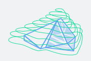
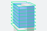
  • Adds support for planning geometric routes in the flight route library for mapping of prism- and cylinder-shaped structures.
Mapping Optimization
  • Point cloud models based on visible photos are now supported during model mapping.
  • Mapping quality reports are supported for models generated in the model library. Users can view the reports in the model list or when previewing models.
  • Users can select formats such as OSGB, OBJ, and PLY when generating models in the model library.
What's Updated
  • Users can now set weather-related flight restrictions for different device models in the project settings.
  • When downloading more than 1,000 photos at a time, photos will be compressed into several packages, and users can select the packages to download.
What's Fixed
  • Fixed certain known issues.
    DJI FlightHub 2 will update storage policy for paid resources recently to ensure its accuracy. Contact DJI Support if you have any questions.
  • Related resources of deleted projects will be cleared and will no longer take up storage space.
  • Errors caused by deleting files in batches will be corrected. Deleted resources will no longer occupy storage space.
  • Models generated in the model library during the beta test that did not take up storage space will be included this time.
  • Due to transmission errors, data that were not counted toward storage will be corrected this time.

2024-4-7
What's New
Slope Routes
  • Adds support for planning slope routes in the flight route library to capture photos for slope mapping.
Multi-Dock Tasks
  • A new multi-dock task feature is added to the plan library. It allows an aircraft from DJI Dock 2 to perform tasks with takeoffs and landings at different locations, enabling continuous flight operations over long distances and large areas.
Subject Zoom
  • Users can now right-click and drag to select a subject to zoom in when viewing the livestream of the DJI Dock 2 aircraft.
What's Updated
  • Optimized the FlyTo performance for DJI Dock 2.
What's Fixed
  • Fixed certain known issues.

Following features are now supported by DJI Dock 2:

  • Media files captured during FlyTo and planned tasks are automatically separated and stored in different folders.
  • Photos and panoramas can be transferred to the cloud in real time during Live Flight Controls.
  • Adds support for panorama and Smart Low-Light photo modes. Setting the exposure value and MF, AFS, or AFC focus mode is also supported.
  • Dock aircraft trial flight, unlocking licenses, silent mode, and flight trajectory playback are now supported.

2024-2-22
What's New
POI
  • FlightHub 2 users can select any location or PinPoint on the map and start POI when DJI Dock is in the Live Flight Controls mode.
Consistent Gimbal and Aircraft Orientations
  • When DJI Dock is in the Live Flight Controls mode and livestream is started, users can now set the gimbal mode as Lock mode. When users double-click the livestream view to change the gimbal angle, the aircraft will adjust its orientation and remain consistent with the gimbal.
Optimized Data Collection Performance
    For DJI Dock:
  • Media files captured during FlyTo and planned tasks are automatically separated and stored in different folders.
  • Adds support for transferring photos and panoramas to the cloud in real time during Live Flight Controls.
  • Adds support for panorama and Smart Low-Light photo modes. Setting the exposure value and MF, AFS, or AFC focus mode is also supported.
  • The infrared camera now supports spot and area temperature measurement and high temperature alarm.
Dock Aircraft Trial Flight
  • Users can now assess DJI Dock's task performance and media file transfer reliability. Click Trial Flight in Device Maintenance and a task plan will be automatically created.
  • The dock aircraft will ascend 60 meters vertically, and the gimbal will tilt down to 90° to take a photo and then return home.
Unlocking Licenses
  • DJI Dock can now transfer unlocking licenses to the dock aircraft in Devices > Dock.
  • Adds support for updating Flight Safety Database for DJI Dock in Devices > Dock.
Dock Silent Mode
  • When enabled in Device Maintenance, noise will be reduced when DJI Dock is in operation.
Flight Trajectory Playback
  • Users can now view the flight trajectory after a planned task is completed by DJI Dock.
FlightHub Sync
  • FlightHub Sync supports forwarding livestream data to third-party platforms.
  • FlightHub Sync supports transferring the dock and aircraft status data, such as location and altitude, to third-party platforms in real time.
  • Bidirectional flight route file transfer between FlightHub 2 and a third-party platform is now supported.
  • Third-party platforms can send notifications with event details such as time, location, and description to FlightHub 2.
What's Updated
  • DJI Dock supports the obstacle data settings.
  • Users can now update the FlyTo destination without interrupting the FlyTo task (for DJI Dock only).
  • Large Restricted Zone can now be bypassed when the DJI Dock aircraft is performing FlyTo tasks.
  • Panorama is now supported when editing waypoint routes for DJI Dock and Matrice 30 series.
What's Fixed
  • Fixed certain known issues.

Note: Certain features mentioned above will be supported by DJI Dock 2 in later versions.
2023-11-23
What's New
Livestream View Sharing
  • FlightHub 2 users can share camera livestreams, and anyone can use the shared link to view livestreams without logging in to the cloud.
Media Files Sharing
  • FlightHub 2 users can share photos, panoramas, and videos, and anyone can use the shared link to view files without logging in to the cloud.
2D/3D Mapping
  • The beta test of cloud mappings and mappings based on media files has ended. Related models will occupy the cloud storage space. Removing unnecessary models recommended.
  • Setting one region of interest before a mapping task is supported.
Photos and Models Comparison
  • Photos Comparison: FlightHub 2 adds support for comparing wide-angle, zoom, and infrared photos taken by the same Take Photo (Fixed Angle) action at the same waypoint. Users can compare when previewing photos.
  • Models Comparison:
    • Users can now compare 2D models that have overlapping areas. The models comparison can be accessed from Model Library or Map Photos.
    • Adding point, line, and area annotations is also supported.
Photo Markup
  • Users can now add shapes and notes when previewing livestream screenshots and previewing or comparing wide-angle, zoom, and infrared photos.
Map Photo Management
  • FlightHub 2 adds support for the map photo management. Users can now preview photos on the map in Map Photos and overlay photos in the same folder onto the map in Media Files.
What's Updated
Flight Route Editor Optimization
  • Users can simply left-click on the map to add waypoints.
More Updates
  • Live Flight Controls: The search result on the map can be directly converted to a FlyTo destination.
  • Setting units of measurement is supported in Organization Settings.
  • Models can be copied to other projects in the same organization.
What's Fixed
  • Fixed certain known issues.
2023-11-15
What's New
New Product Support
  • Adds support for DJI Dock 2.
Obstacle Data
  • Obstacle Data is now available in Task Area Management. Data can be transferred to Dock 2 and used for the FlyTo tasks and the RTH planning.
What's Updated
Auto Planning of Optimal Route
  • Adds support for the optimal route planning during the FlyTo tasks and RTH for Dock 2. Users can enable settings when editing task plans or when aircraft is in the Live Flight Controls mode.
More Updates
  • Adds support for viewing or setting eSIM for enhanced transmission for Dock 2.
  • Adds support to automatically bypass obstacles during flight for Dock 2.
What's Fixed
  • Fixed certain known issues.
2023-09-18
What's New
Area Route
  • Adds support for area routes to collect ortho or oblique photos.
Cloud Mapping
  • Cloud mapping beta is now available. Users can start area route task to capture photos or upload photos from DJI Pilot 2 and complete 2D or 3D mapping in cloud.
Custom Flight Area
  • Task Area Management is now available to increase task safety. Users can create custom task areas or GEO Zones and synchronize data to dock and Matrice 30 series in the same project.
PSDK Support in Live Flight Controls
  • Adds support for PSDK devices. Users can now view PSDK device info and control device after Live Flight Controls is enabled in device status window.
  • Adds support for speaker to broadcast directly or convert text to speech.
Other Updates on Live Flight Controls
  • Adds support for laser rangefinder to determine subject distance to aircraft and set subject as a PinPoint. Users can click Face PinPoint, and PinPoint will be centered in liveview.
  • IR camera now supports IR palette, temperature bar, and displaying zoom and IR camera views side by side.
  • Gimbal action now includes Gimbal Down and Gimbal Tilt Down.
  • Users can drag livestream view with mouse to change gimbal orientation or use keyboard shortcuts to fine-tune gimbal angle.
  • Setting Task Altitude is supported for enhanced flight safety. Users can now set the lowest altitude of aircraft when performing tasks.
  • Adds support to remotely control aircraft with key combinations.
Media File Direct Transfer
  • Media File Direct Transfer is released for efficient data synchronization. Users can add third-party cloud service address in Organization Settings, and media files captured in tasks will be directly transferred to third-party platform.
  • See FlightHub Sync Documentation for more details.
What's Updated
No-Return Points
  • When editing waypoint route, waypoint with obstacle above it can be marked as no-return point. Area including no-return point and the route to its previous and next waypoints will be marked as no-return area. When aircraft is in no-return area and RTH is triggered, aircraft will follow route and fly out of the area before ascending to RTH altitude and returning to home.
Smart Return to Home
  • Return to Home is updated. Dock aircraft can automatically bypass custom or DJI GEO Zone when returning to home.
More Updates
  • Users can copy and rename waypoint routes. Waypoint routes performed by the same device type can also be merged into one.
  • Adds support for online user manual (HTML version).
  • Adds support to set keyboard layout as QWERTY, QWERTZ, or AZERTY in User Center > Preferences.
What's Fixed
  • Fixed certain known issues.
2023-07-19
  • Adds support for dock log upload.
  • Adds support for displaying obstacle data collected by ToF sensor during Live Flight Controls.
2023-05-31
  • Free trial of DJI FlightHub 2 cloud platform will expire on June 30, 2023. Go to My Organization to view available livestream minutes, cloud mapping images, and storage space. Contact local dealer to purchase service if needed.
  • What's New and Updated
    • Dock Live Flight Controls
      • Adds support for IR camera zoom.
      • Adds support for adding PinPoint on livestream view and obtain PinPoint location.
      • Optimized beginner guide and error message prompt.
    • Dock Operation Reliability Improvement
      • Adds hourly weather forecasts of dock task area.
      • Adds flight restriction based on set conditions.
    • Flight Route Editor Optimization
      • Adds support to adjust waypoint action order by drag-and-drop.
      • Optimized interface design.
    • Adds support to enable HD model in lower right corner of the map.
    • Optimized error message prompt when uploading models.
  • What's Fixed
    • Fixed display error of some 2D models.
2023-05-18
  • Adds support for DJI Matrice 350 RTK.
  • Fixed some known issues.
2023-05-05
  • New Flight Route Editor:
    • Adds support to use mouse and keyboard to control virtual aircraft and plan waypoint route.
    • Adds support to capture subject based on imported 3D models.
    • Adds support for displaying media files captured by Matrice 30 series dock version after taking fixed-angle shots. Users can adjust shooting angle to capture desired view if photos captured are not as expected.
    • Adds support for AI Spot-Check flight route editing (beta version). Subject will be automatically matched by AI algorithm and captured during flight.
2023-04-25
  • Adds support for Live Flight Controls of dock aircraft.
    • Adds support for one-click takeoff and pause, FlyTo task, and manual operation after obtaining aircraft control in cloud.
    • Adds support to operate gimbal, switch cameras, take photos, record videos, zoom on livestream view after obtaining payload control in cloud.
  • Adds support for resuming flight from breakpoint.
  • Adds support for email and message notification.
  • Optimized Schedule and Standby charging modes by increasing battery storage level and fully charging battery automatically before task is started.
  • Improved media file download speed.
  • Fixed issue where media files could not be uploaded to cloud when flight was not complete and Stop Recording action was not performed.
2023-03-09
  • Adds support for adding tags to media files.
  • Adds support for creating folder to organize flight route files in Flight Route Library.
  • Optimized user experience when switching between aircraft models in waypoint route task.
  • Adds Smart Low-Light mode in waypoint route task.
  • Features related to DJI dock:
    • Adds support to display more aircraft battery statuses, including warming up, maintaining temperature, maintenance required, and maintaining battery.
    • Adds remote control of AC in DJI FlightHub 2.
    • Adds support to distribute AI Spot-Check task to dock.
    • Adds support for Continuous task plan in Task Plan Library.
    • Adds support for displaying aircraft battery information when aircraft is inside dock and powered off.
    • Adds support for automatically resuming livestream after network or transmission becomes stable again.
  • Fixed certain known issues.
2022-12-19
  • Adds support to close dock cover when aircraft is not inside dock.
  • Adds support to display number of takeoffs for Matrice 30 series dock version on DJI Maintenance Program page.
  • Adds support for beginner guide after entering FPV view in flight route editor.
  • Fixed certain known issues.
Note: Distributing AI Spot-Check flight task to dock in task plan library is currently not supported.

2022-11-17
  • Adds support to use DJI Dock together with Matrice 30 series dock version to perform one-stop aircraft task cloud management. Users can deploy dock, remotely manage flight tasks, and access and archive data. Supported features include:
    • Dock Deployment: Adds support for dock site selection, local debugging, and deployment in DJI Pilot 2. Users can configure network, calibrate location, set alternate landing site, view device status, and debug modules in app.
    • Task Plan Library: Adds support to manage Immediate, Timed, and Recurring task plans and distribute tasks to dock. Users can view aircraft camera liveview, flight route, and trajectory when aircraft is performing task. After task is complete, data will be automatically be uploaded to cloud, and users can choose to archive data.
    • Remote Debugging: Adds support to remotely debug dock and view device status and warning messages in device status window and maintenance panel. Users can also remotely update firmware, debug devices, and report issues.
  • Adds support for FPV view in flight route editor for Matrice 30 series and customizing waypoint actions on 3D model, providing immersive experience while editing.
  • Adds support for importing models in PNG, TIFF, PNG+TIFF, PNTS, LAS, or B3DM format to Model library. Supported models include models generated by DJI Terra. Users can choose to display models on map and create digital sand table when needed.
  • Adds support for Map Lab. Users can click Map Lab icon in the bottom right corner of the map to enable Building Model.
  • Optimized video loading time and playback performance in Media Files.
  • Fixed certain known issues.
2022-11-08
  • Adds support to import KMZ flight route in Flight Route Library.
  • Adds support for displaying flight trajectory in Flight Route Library.
  • Adds support to customize storage format when setting waypoint actions such as taking photo or video in Flight Route Editor.
  • Adds support to display waypoint action list and switch editing between flight route and waypoint action in Flight Route Editor.
  • Adds support for pano preview to display PinPoint and photo location info within a 5km radius of where the panorama was taken.
  • Optimized accuracy of estimated task duration performed by Matrice 30 series aircraft.
  • Optimized loading speed of photos and panoramas in Media Files.
2022-09-27
  • Adds support for DJI Mavic 3E and Mavic 3T.
  • Fixed some known issues.
2022-06-16
  • Added support for user feedback.
  • Improved user experience when using DJI FlightHub 2 on tablets.
  • Fixed issue where colors of lines and shapes not displayed after importing KML files generated by Google Earth.
  • Fixed some known issues.
Last Updated: