Project Engineering Coordinate System Settings
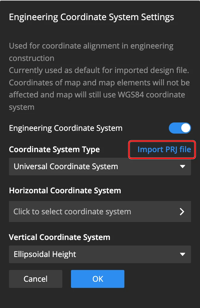
In the project settings, you can enable the engineering coordinate system settings. This coordinate system setting is only used when importing design files, and does not affect the coordinate system of the map or map elements within the project. The map will still use the WGS84 coordinate system.
General Coordinate System
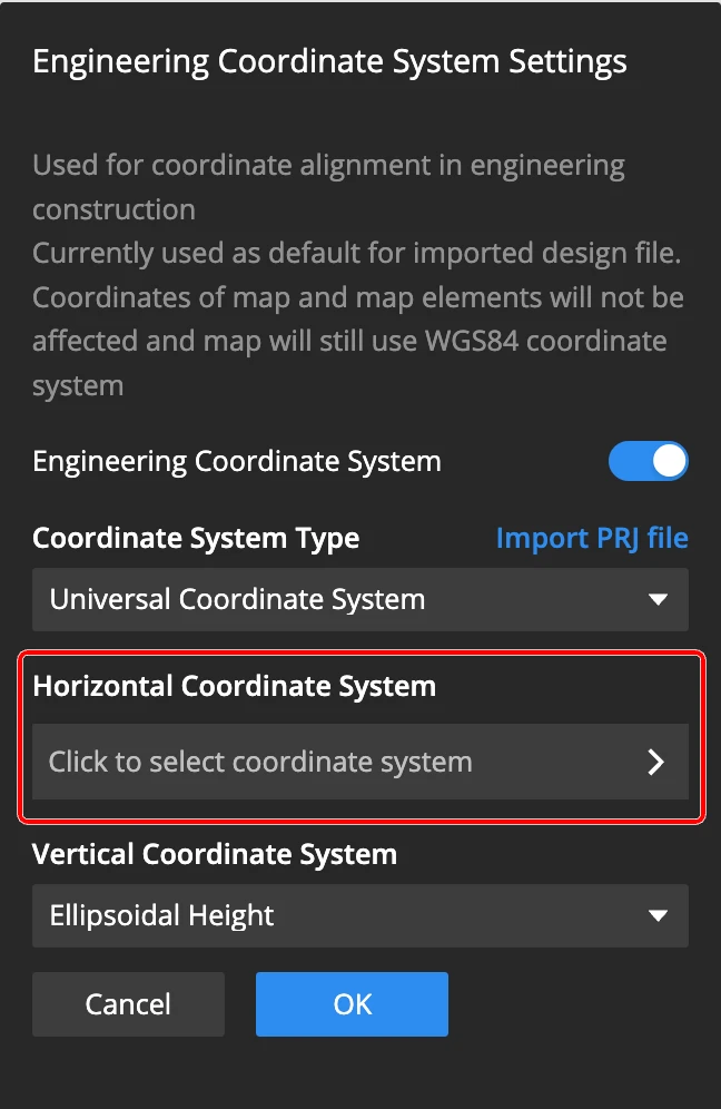
Supports setting EPSG code for the general coordinate system.
Custom Projected Coordinate System
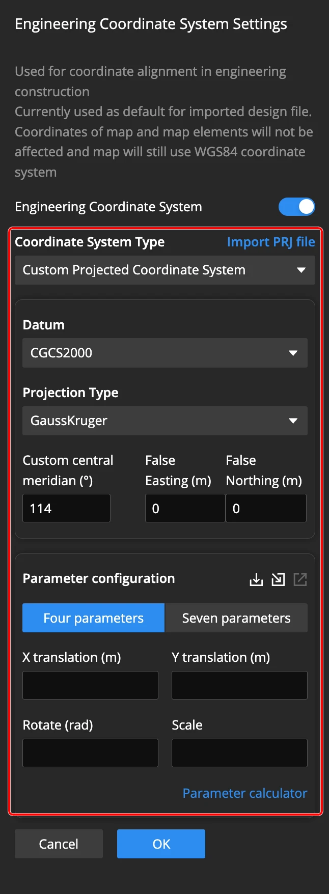
Supports customizing the projected coordinate system by setting the following parameters:
- Datum: CGCS2000, WGS84, Beijing 54, or Xi'an 80
- Projection Type: Gauss-Kruger, UTM, or Web Mercator
- Custom central meridian
- False easting and northing
Four- or Seven-Parameter Configuration
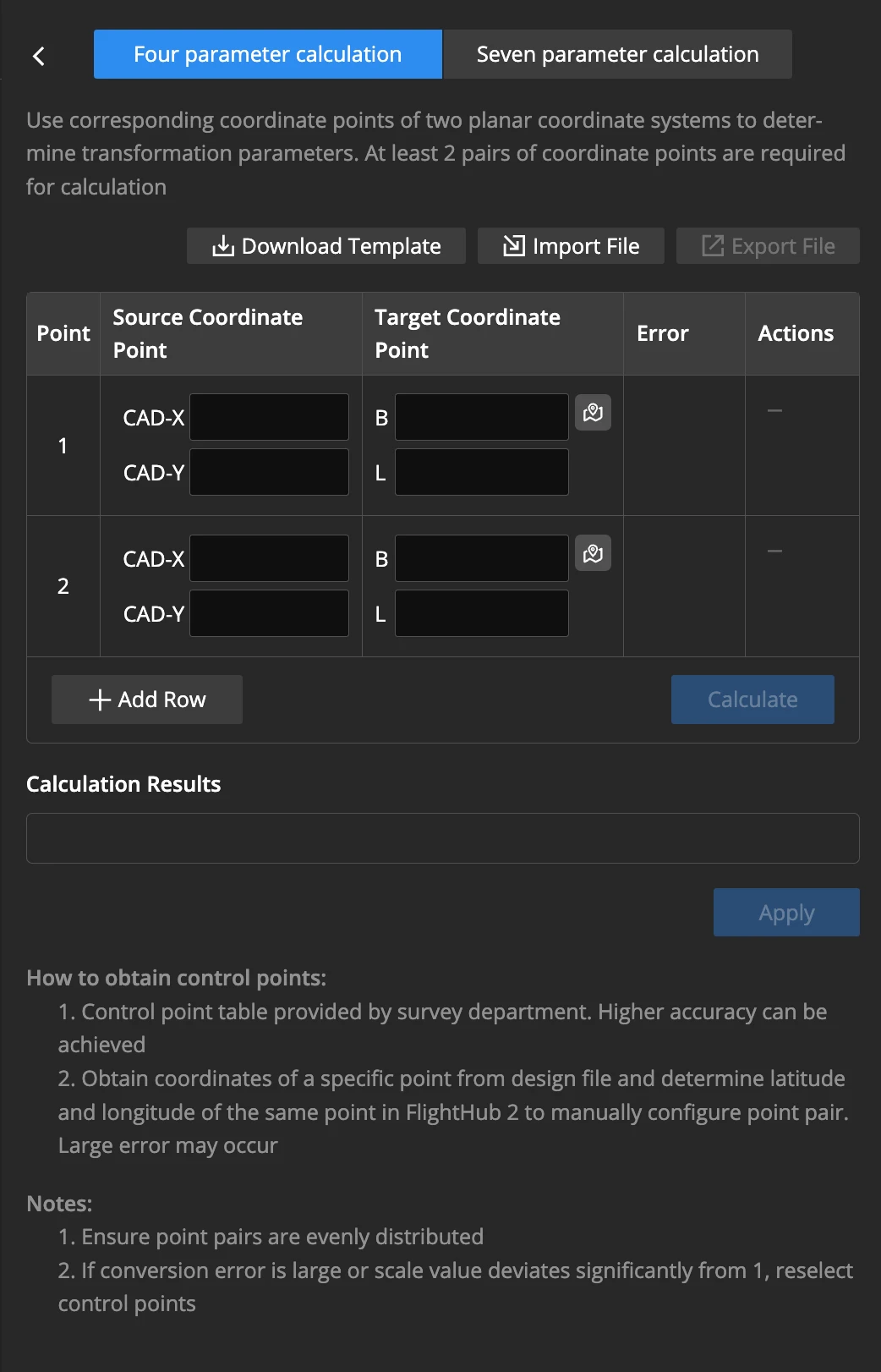
- Supports direct import of parameter files in the CSV format.
- Supports four- or seven-parameter transformations using control point pairs.
PRJ File Import
You can import PRJ files that define coordinate systems. The system will read and apply the coordinate system information from the PRJ file automatically.